Bikerafting the Outer Hebrides, Scotland
Copy by: Huw Oliver
Photos by: Huw Oliver & Annie Le
Huw Oliver and Annie Le took a trip to the Outer Hebrides, off the west coast of mainland Scotland. Their trip combined packrafts and bikes for a fun and beautiful adventure. Check out this great photo essay that Huw put together highlighting the trip. Dont miss the film and additional article at the end.
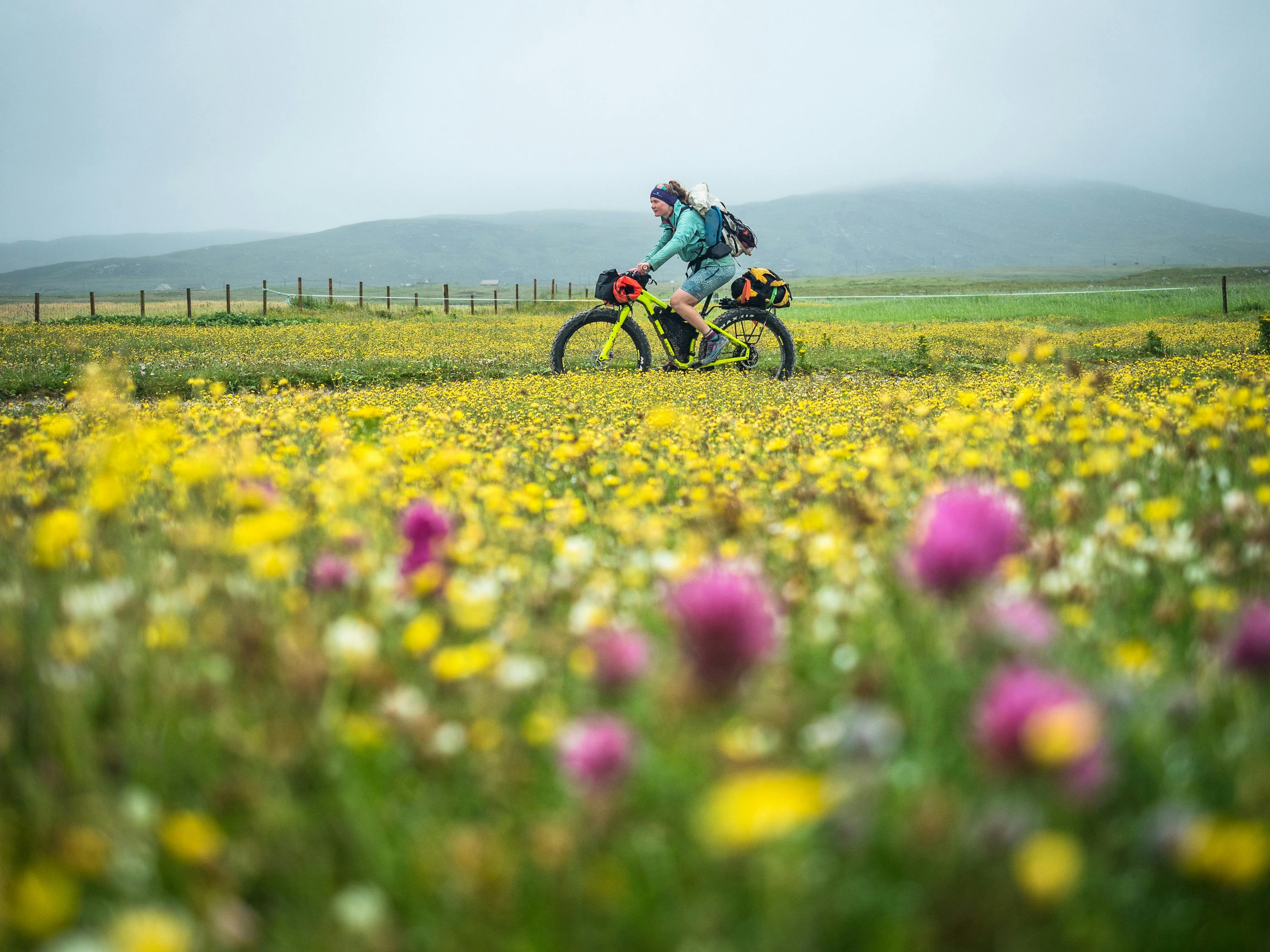
The machair is an incredibly rare habitat, found only on the wild Atlantic coasts of western Scotland and Ireland. From the calcium-rich shell sand heaped up by the rolling waves grows an incredible abundance of wildflowers that is home to a diverse range of insect, birn and animal life. It provides the islands with its fertile heart, as the moors of the background are all acid peat soil that supports relatively sparse plant life and is no good for growing crops. Generations of islanders have used the machair to graze their sheep and cattle, and to grow oats, potatoes and other vegetables. In July, the lightly grazed grasslands burst into bloom and become one huge carpet of colour as the buttercups, gentians, ox-eye daisies, clover, orchids and dozens of other flowers all bloom. It's an incredible place to ride, as well as being a reminder that human exploitation can go hand in hand with diversity and a healthy ecosystem.
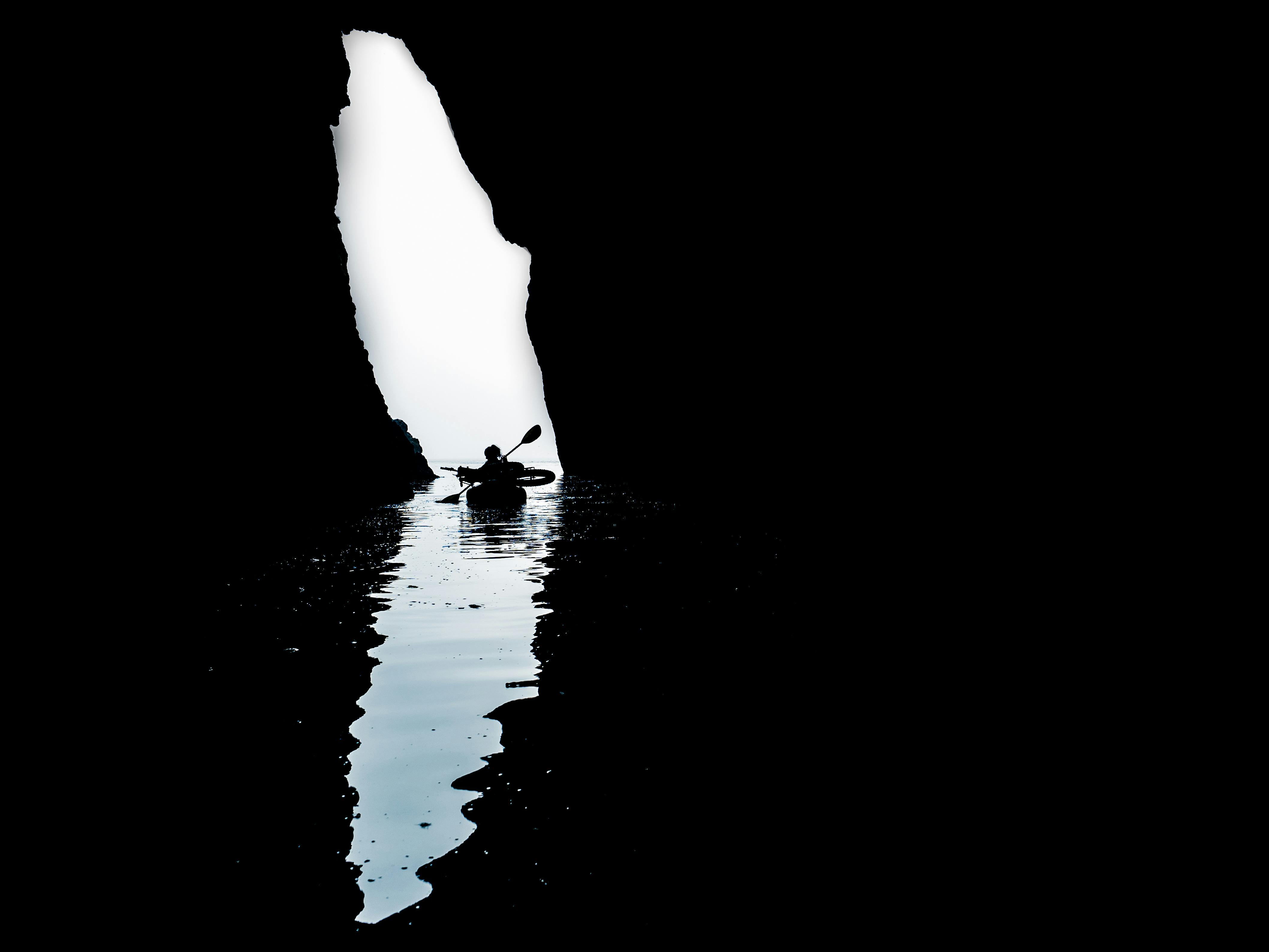
Beneath a lighthouse-topped headland, we noticed a fissure in the rock that seemed to lead right into the cliffs themselves. Never ones to turn down a chance for some snooping, we spent an hour or so exploring the cave, watching the seafloow below the glassy water and listening to the distant boom of waves at the furthest reaches of its deepest channels. It was the first time that I've needed a head torch to go paddling, and the sensation of sitting still with the torches turned off in the dar was downright eery.
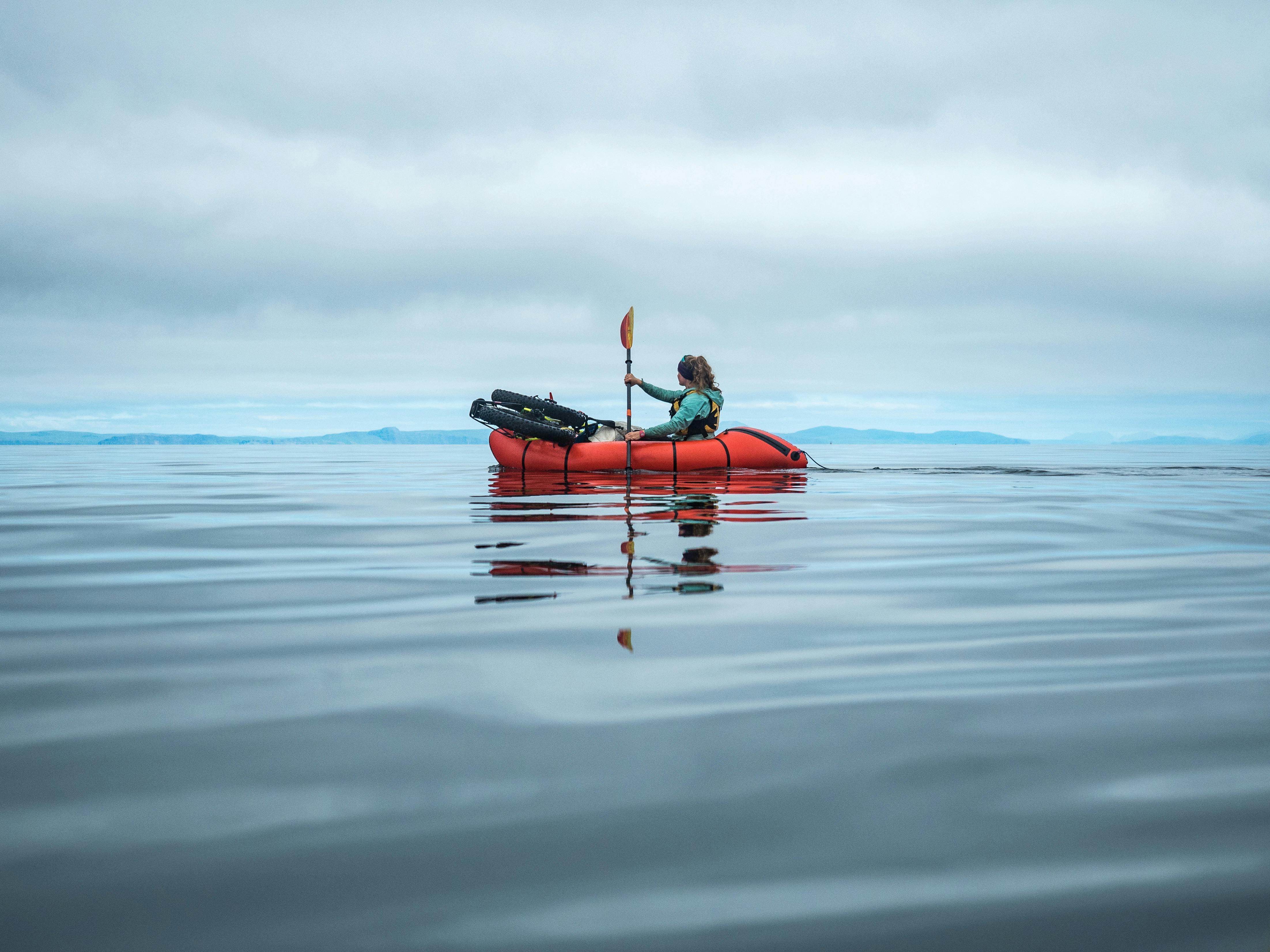
After several days of strong winds, the promised lull arrived and delivered glassy calm conditions for the most exposed part of our paddling route up the east coast of South Uist. We made the crossing to Benbecula across a mirror-smooth sea that felt worlds away from the crashing breakers of the west coast just a few days before. We watched Guillemots land awkwardly on the water, terns dipping lightly in search of small fish to hunt, and a seal that broke the silence several times by leaping clear of the water, something that neither of us had seen before in Scotland.
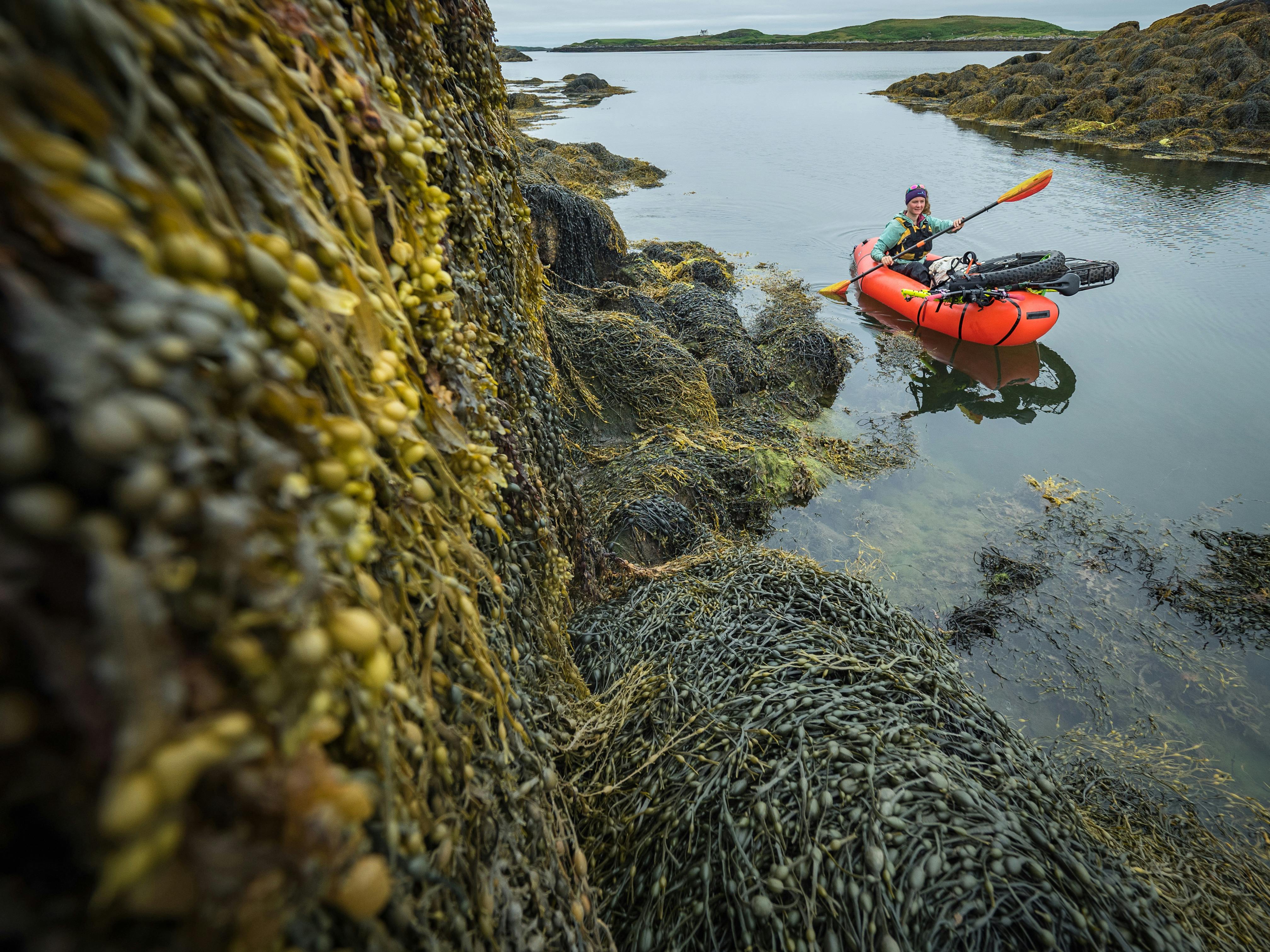
The white sand beaches steal all the headlines in tourist brochures, but the seaweed-covered rocks of the east coast were home to countless corners asking to be explored, and at low tide the burnt yellow of the bladderwrack added colour to an otherwise overcast scene. The skerries and channels of the rocky coastline made navigation challenging, and more than once a quick trip to the summit of a skerry confirmed which channel we needed to take. Many of the more prominent ones were topped by an old cairn, evidence that other water-goers had faced the same challenges before us!
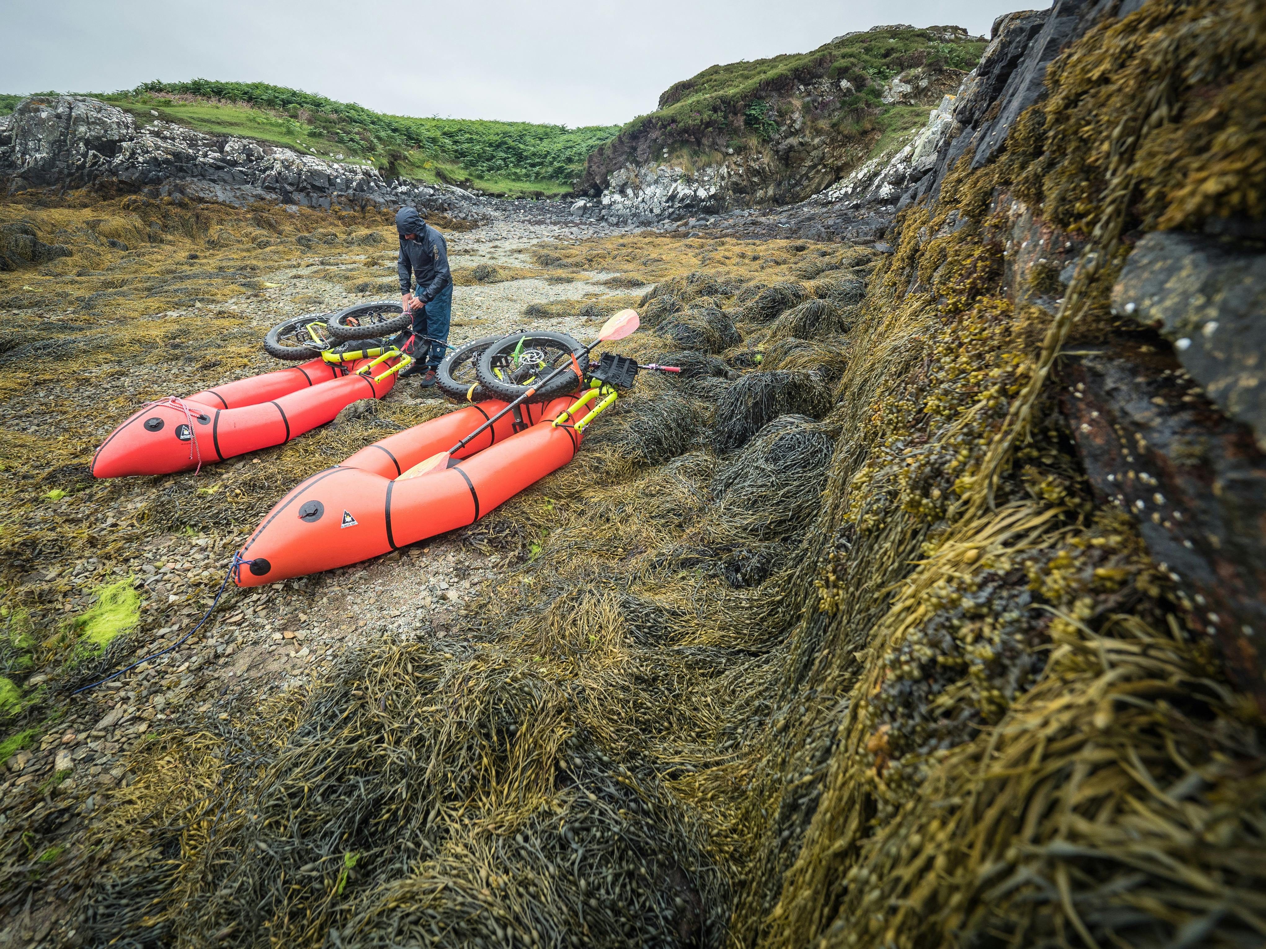
This old harbour wall betrayed the fact that this deserted section of coastline on benbecula was once home to crofters who will have used this tiny harbour as shelter for their boats, and to move livestock and supplies in the absece of decent roads. We were drawn to it on an overcast morning while we were searching for an easy spot to land and switch to biek travel among the rough coastline. All over the islands we found that packrafts gave us a diferent perspective to normal, and one that brought out hidden details of the lives that were spent here at a time when things were very different.
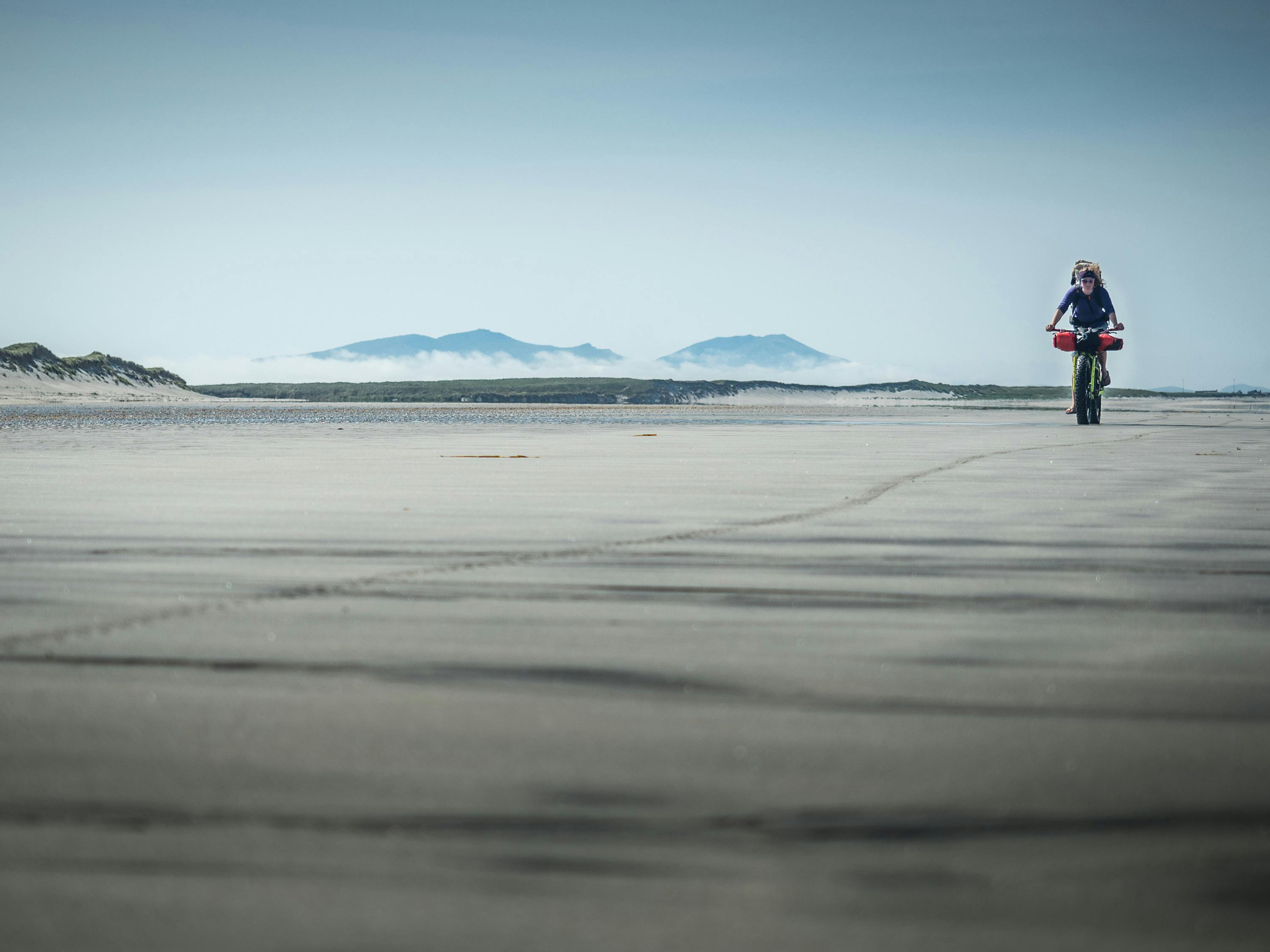
Throughout the miles of open beach riding, the hills of South Uist were visible evry time the clouds lifted. Beinn Mhor means Great Hill in the Gaelic and is the highest point on the Uists. Its neighbour Hekla takes its name from an Old Norse name meaning cloak, which probably refers to the fact that it's often well hidden in the low cluds that hug the islands!

A string of barrier islands protect the west coast of North Uist, formed from the shells of countless sea creatures that produce the bright, white sand of the beaches and dunes. After pedalling along the shore, frequent short crossings were needed to avoid detours inland. They may only be a couple of hundred metres across, but these channels hide rapid tidal currents as they drain the lagoon in the background, and behave more like powerful rivers during peak tidal flows. A little planning (and a lie-in) allowed us to cross them at low tide when things were a lot calmer.
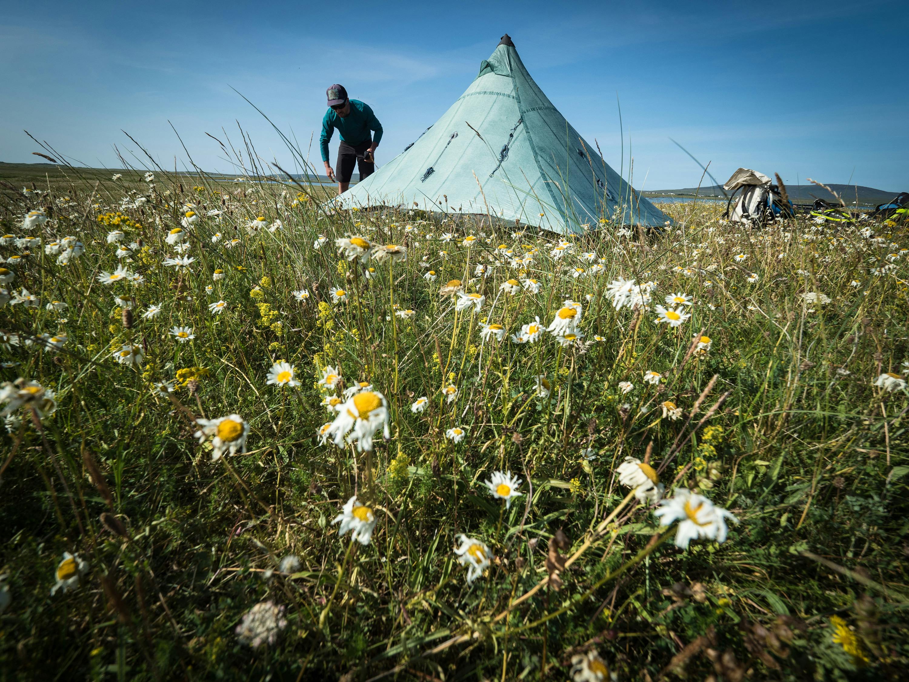
Blue skies and a bed of wildflowers are the things that dreams are made of. The ox-eye daisies were beginning to wilt in the late July heat, but every time we visit the hebrides the abundance of summer plant-life is always a beautiful thing to see. If you were to visit duting the windy, bleak winter months you would never guess that so much vibrant life could be squeezed into the short summer months.
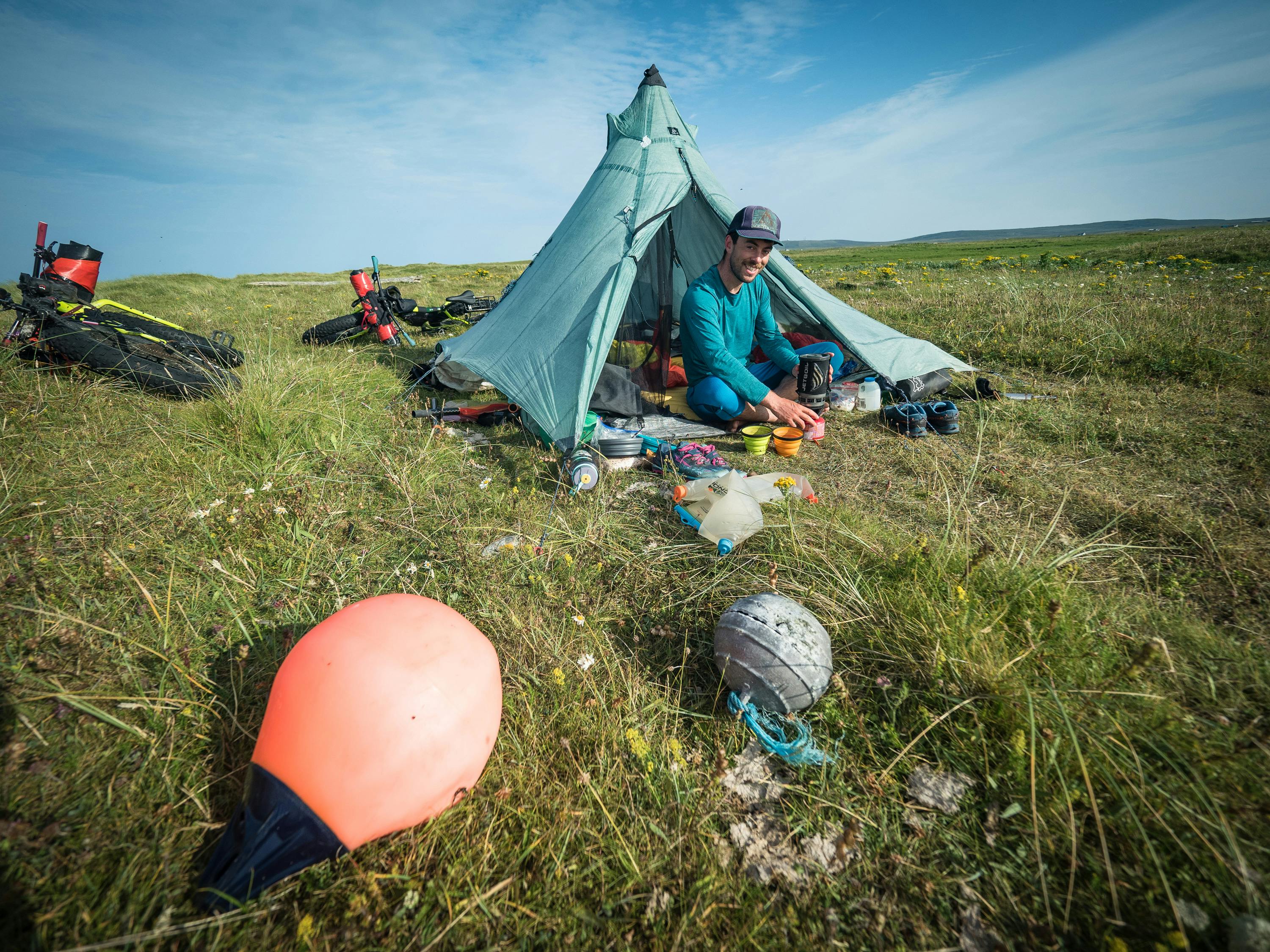
The machair grassland of the Hebrides' west coast are a picturesque place to pitch your home for the night, but like anywhere on our planet, the influence of human activity is unmistakeable. These two fishing buoys are evidence of the importance of fishing in the rich waters of the Atlantic, but while the orange buoy is modern, plastic and destined to stick around for a long time, the aluminium buoy on the right is a little bit special! We researched its distinctive embossed lighthouse design, and found out that it's around 100 years old and was made in Spain — it likely drifted this way on the currents and found a second life as a creel-marking buoy before breaking free again and coming to rest among the dunes of Kirkibost.
Want more?
Interested in reading more about this trip? The duo shared shared a longer article and film about the trip with Bikerafting.com. Take a look at the links.