Mapping Lechuguilla Cave
Words and photos by: Stephen Eginoire
At the foot of New Mexico’s Guadalupe Mountains in Carlsbad Caverns National Park lies one of the world’s great subterranean anomalies, Lechuguilla Cave. The portal to this extraordinary underground wilderness is quite literally a hole in the ground, and up until 1986, was known only as a historic mining claim where a pair of dusty prospectors attempted to harvest bat guano. For those engaged in cave exploration, the hole was more or less thought to dead end after a short distance. Nor is it an uncommon feature in a karst landscape riddled with mysterious holes. Still, it provoked a curious few, given its close proximity to the Park’s namesake, the grandiose Carlsbad Caverns. But some became obsessed, lured by the strong airflow that at times would audibly howl through the tiny spaces between boulders at the so-called dead end. In this mountain range, the crust of the earth actually breathes, inhaling and exhaling cool, clean wind as giant, underground voids adjust to the rise and fall of barometric pressure. There is no bigger clue suggesting the presence of a cave than when wind emerges from deep underground.
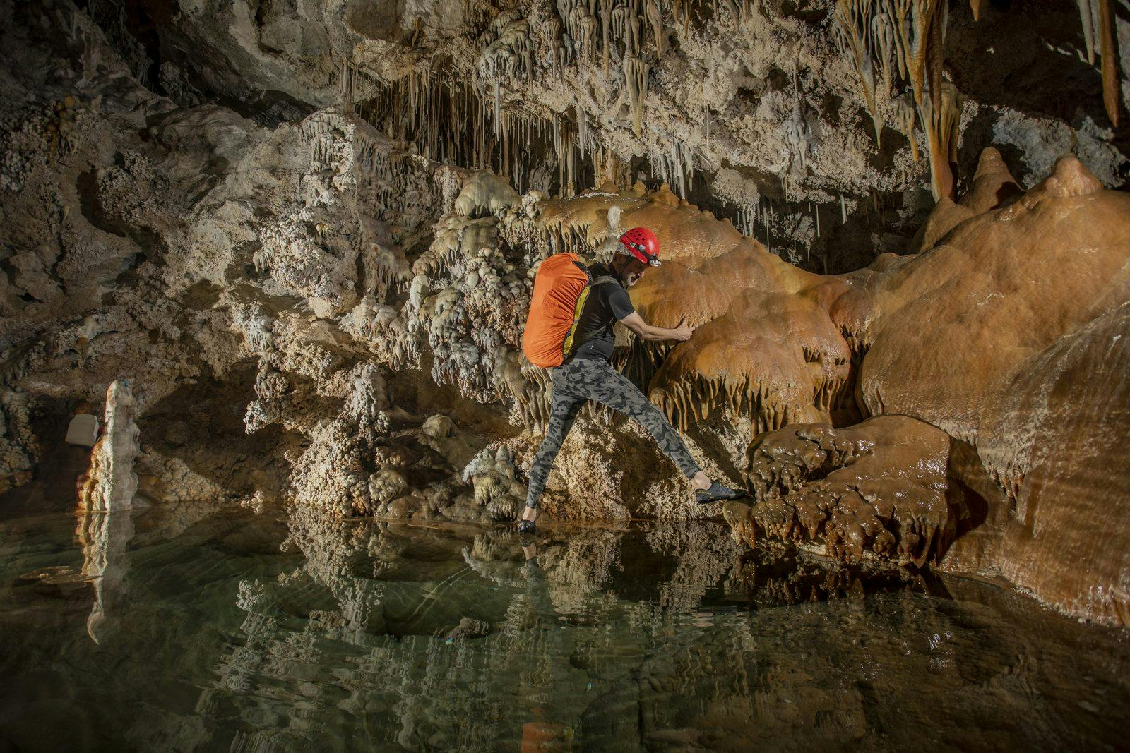
It wasn’t until Colorado resident Dave Allured spearheaded a two-year digging crusade (with the Park’s permission) that the blockage was breached. And breached it was, holding back a veritable dam of air that immediately rushed through their dig, blowing dust, rocks, and hair with gale force. Entering what had been sealed from the world above, they followed a tunnel into total darkness, past pools, dripping walls, and exquisite formations until they arrived at the edge of a gaping, photon swallowing chasm very obviously plummeting deep underground. After hugs, high-fives, and maybe even a few tears, Allured’s team exited the cave to retrieve all the rope they could find. The explosion of discovery that ensued is fabled among cave explorers the world over.
34-years later, specialized survey teams have painstakingly mapped over 150 miles of passage inside Lechuguilla Cave, including areas reaching the water table over 1,600 vertical feet below the surface. There are only seven other caves in the world known to be longer, but Lechuguilla’s unusual origin puts it in a league all of its own, brought into existence when a potent solution of water and hydrogen sulfide gas seethed upwards into faults, fissures and any other weakness in the limestone bedrock. This acid-laced water aggressively dissolved vast chambers, huge boreholes, and wandering mazes. Other chemical reactions inside the cave produced a huge variety of incredibly rare formations that often leave those studying the cave in a state of bewilderment.
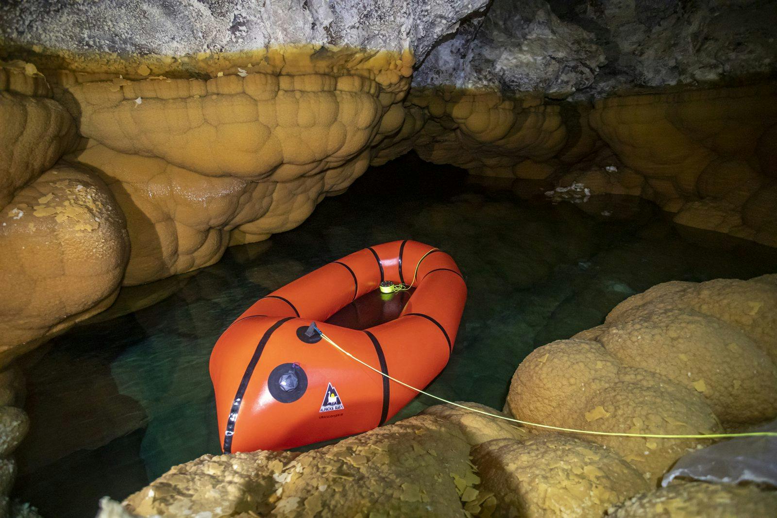
Discovery within Lechuguilla Cave continues to this day as explorers systematically push further into the unknown. It is the goal and responsibility of every expedition to not only contribute to a greater understanding of the cave but to ensure the preservation of this invaluable resource. This past February, a team of specialists led by Dr. Hazel Barton spent 8-days underground, mapping a remote area of Lechuguilla known as The Voids. Of our various Park-approved objectives, the most tedious was crossing Lake Castrovalva.
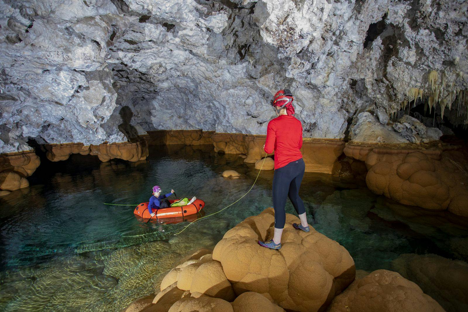
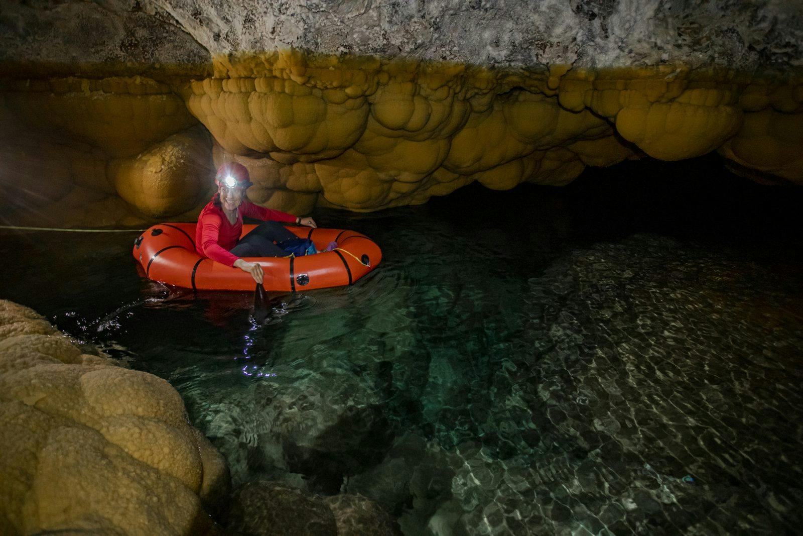
There are few places on this earth where the by-products of human progress are virtually non-existent. As life on the surface is subjected to countless externalities like pollution, extraction, and overuse, Lechuguilla Cave will remain a refuge for discovery, and home to some of the only true wilderness left on earth. Places like Lake Castrovalva are increasingly important, where unimpacted environments can be carefully studied and observed. To this end, it was of utmost importance to leave minimal traces of our passing as we sought to produce an accurate survey of what lay beyond Castrovalva’s rimstone shores. Swimming across was out of the question for obvious impact reasons, so we opted to utilize a disinfected 3.25-pound Alpacka Scout packraft. With minimal impact, our team easily paddled to the far side of the lake to tackle our survey goals, including the photo-documentation of this magical lair.
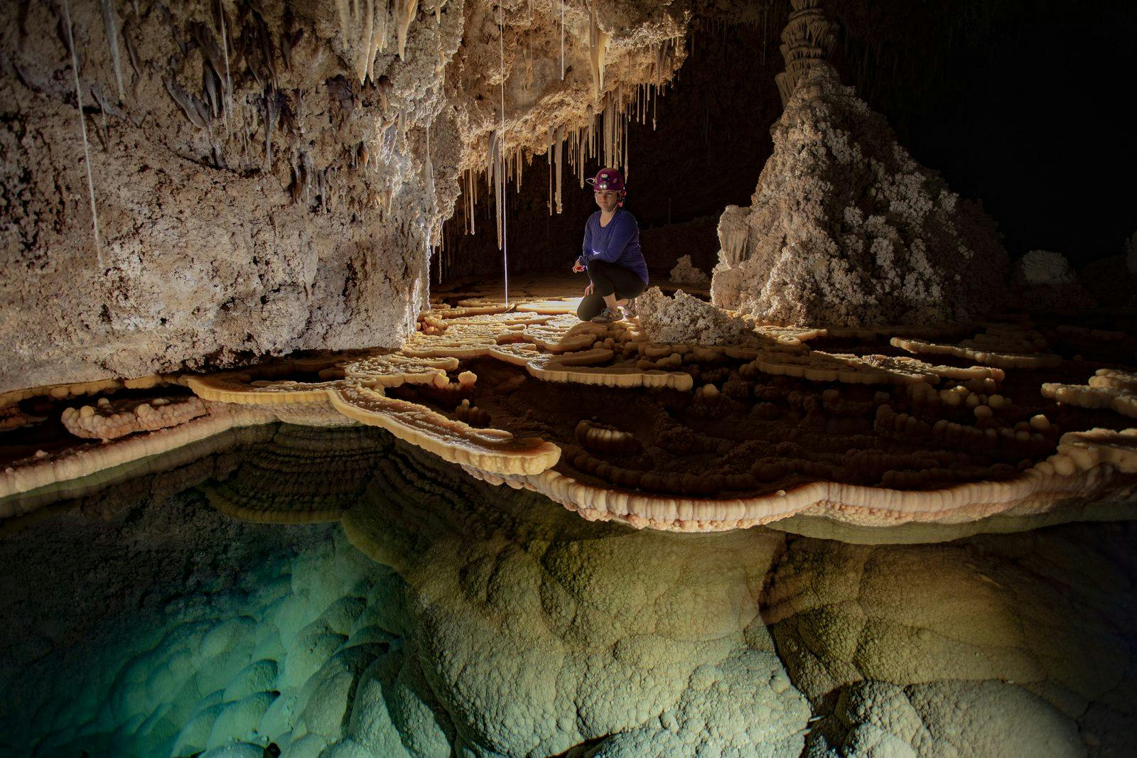
The water in Lake Castrovalva is simply perfect. Encased in cloud-like mammillary formations, shelves of sparkling rimstone overhang deep, turquoise pools. As our headlamps penetrated its depths, waves of light cast along the room’s bleach-white ceilings was a stark contrast to the utter darkness in which the cave exists. Tiptoeing across giant calcite lily pads in sterilized gear, we began the meticulous job of mapping the room. Our survey turned up no new passage, the only potential leads sealed by flowstone. We deemed the area “finished” acquiring all the data needed to draft the area into a final map form.
Upon our exit, I wondered when the next time humans will ever set foot on the far side of the lake. With the map finished, access to this extremely sensitive area will surely be limited to science, and even those trips will be few and far between. In some circumstances, preservation of these wild places means never going back.
It’s a humbling experience to be immersed by an unimaginable place, and I sleep better at night, knowing that place is there, existing in total darkness, safe and sound.
To see more of Stephen Eginoire’s work and some great adventure stories like this one, check out ‘The Gulch’ magazine.

